|
|
Post by timeforachange on Aug 14, 2013 9:27:44 GMT -8
Is it just me, or does it seem like this recent google earth image of the school (I JUST screencapped this) has been replaced with a cartoon likeness of the school? 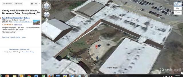 |
|
|
|
Post by Bruce on Aug 31, 2013 11:27:08 GMT -8
The overlays and masks you see are from people who are working with Google Earth. The may be fooling around adding a second story, or changing the playground. There are two versions of google earth. The browser version and the one you download where you can add 3d buildings etc. Download Google Earth and it will give you a new perspective on the building and grounds. There are little boxes on the left where you can click on different things such as 3d, etc. That being said, there has been a survey floating around the net, possibly from 2010 with a Newtown Bee water stamp. It is of the same area and reveals massive elevation plans for that area. Zoom your browser in about 200 percent and you can see what was planned. You can see the area of interest is for the corner of Washing and Riverside roads but it does not match Google Earth as it is today. I found this interesting, as it was long before the shootings. Again, nothing out of the ordinary I can see that would be connected with SHES. Perhaps something proposed that never came to be! Link is, sandyhooktruth.wordpress.com/2013/03/24/more-evidence-that-sandy-hook-elementary-was-not-a-school/sandy-hook-center/ |
|
|
|
Post by timeforachange on Sept 1, 2013 17:24:55 GMT -8
I think I should have been more clear to say that it used to be a true picture of the school before.... right after the shootings. And now it's a "cartoon-ish" image. I found it strange
|
|


